Experience Virginia’s hidden gem of Mountain Biking
20+ miles of single-track goodness at Pleasant Grove
Go the Distance
Looking for long rides of old-school single-track? Pleasant Grove is the place for you. Our extensive network of MTB trails means there’s something for everyone. Learn more about what makes Pleasant Grove special.
Coming Events & Races
Mountain Bike Skills Clinic 8
Enrollment deadline: 3/21/2025 12:00 PM
Are you looking for a local mountain biking skills class to learn more about trail riding? You found it! You will learn and practice basic mountain biking skills necessary to navigate the trail system at Pleasant Grove Park.
Rockabilly Rumble
April 5
Get ready to rumble because the Underground Race Series is back again with a vengeance! This will be a 4-race XCO spring series where your best 3 races count towards regional championship status.
Virginia State MTB Marathon Championship
June 1, 2025
This will be a 2-day MTB festival atmosphere. There will be camping available Saturday night along with a beer garden, food trucks, and vendor expo areas both Saturday & Sunday!
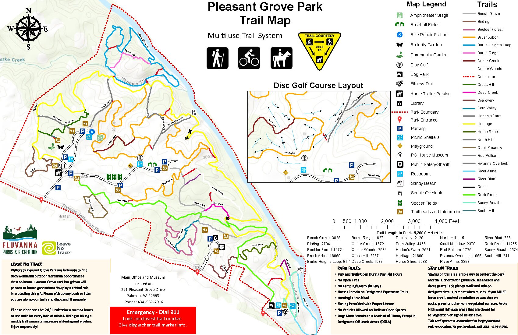
Trail Maps
Heritage Trail
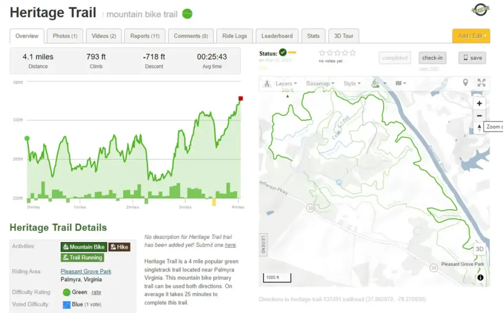
4.1 Miles
Details:
-793 ft climb
–718 descent
-Average time: 25 Minutes
Notes:
Created in the late 90s by our friends at the Historical Society, the Heritage Trail was created in an effort to promote outdoor recreation. Complete with old school yellow blazes and bright colored markers, the trail is the oldest and longest in the park. It is a point to point that follows the Rivanna river and connects Fluvanna County High School to the dog park at the eastern trail head. Use it to train for your first AT adventure or just enjoy for the day. Intersections include Brush Arbor, Reds, Rock Brook, and may connectors.
Burke Heights Loop
Distance:
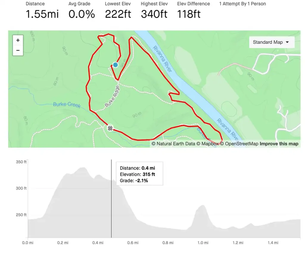
1.55 Miles
Details:
222 – 340 lowest to highest elevation
Notes:
Mile and a half mostly technical loop that starts at the bottom of Reds Trail just across Burke Creek. It’s a tight single track that begins with a hefty climb up what seems like a creek bed (because it was). Trail becomes flowy but narrow after the climb and takes you left at the sign to send you down another old creek bed. This leads you to a nice, flat run that follows the Rivanna River for a spell before sending you up another gnarly climb that leaves little room for error.
Birding Trail
Distance:
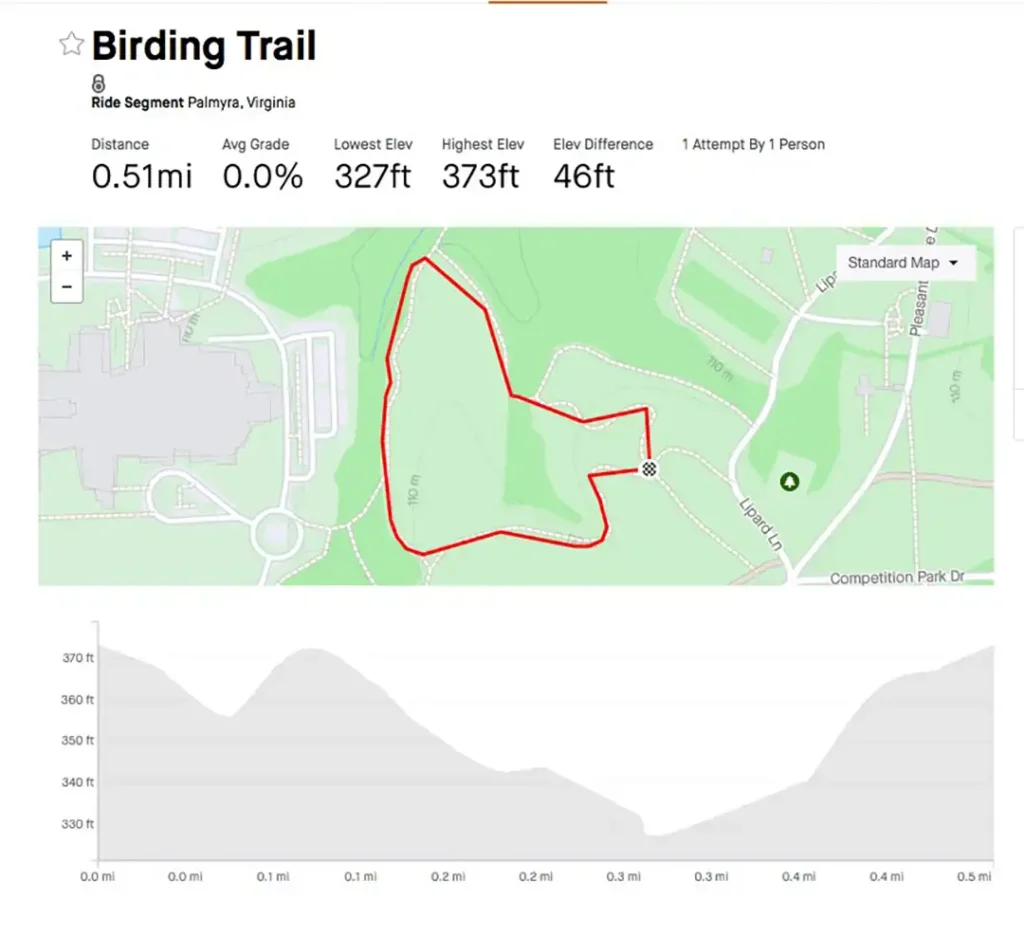
.51 Miles
Details:
327 – 373 Lowest to highest elevation
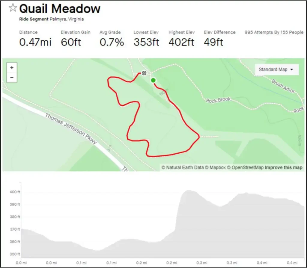
Quail Meadow
Distance:
.47 Miles
Details:
353 – 402 Lowest to highest elevation
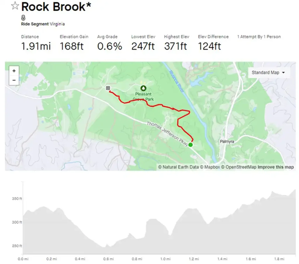
Rock Brook
Distance:
1.91 Miles
Details:
247 – 371 lowest to highest elevation
Notes:
Rock Brook is a 2-mile point to point route that starts you off from Quail Meadow and dumps you out at the dog park in the Eastern Trailhead section. Use in either direction. It is filled with rocky, rooty twists and turns as well as easy, flowy single track. Perfect for riding, hiking, and contemplating. Take a map, there are several intersections including Fern Valley, Beech Grove, Heritage, Horseshoe, and a few connectors.
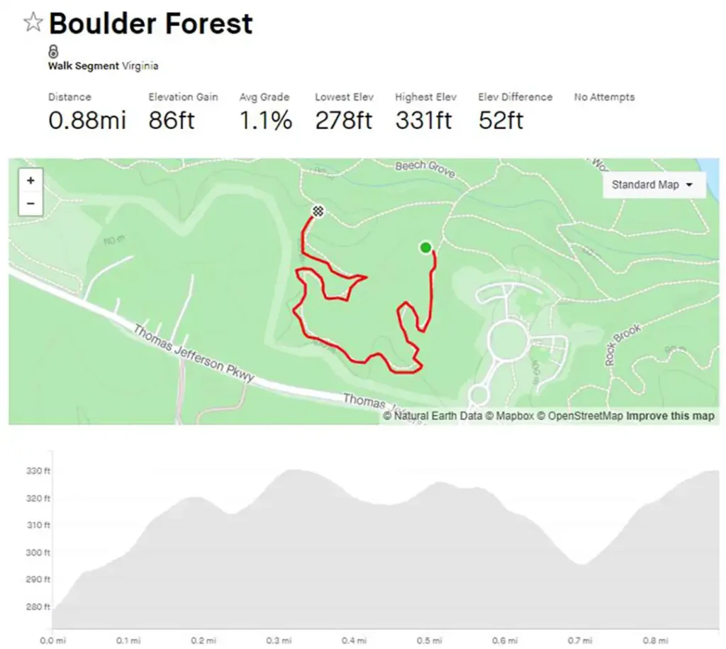
Boulder Forest
Distance:
.88 Miles
Details:
278 – 331 lowest to highest elevation
Notes:
Easily accessible from the library, Boulder Forest is recently added trail that comes off the Beech Grove/Fern Valley intersection. It meanders through the woods for just less than a mile and drops you off at Rock Brook. Turn right to make the loop back to Beech Grove or left to head towards the main park.
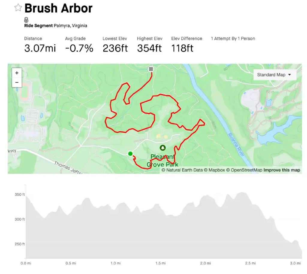
Brush Arbor
Distance:
3.07 Miles
Details:
236 – 354 lowest to highest elevation
Notes:
Fair length single track out and back ideal for hikers, bikers, runners, and horsey pals. Rooty and rocky in some spots with two small creek crossings. Flowy and smooth in the middle with a nice half mile descent on the finish. Finishes fast at Burke Creek with options to loop back on Hadens or Heritage or continue onto Burke Creek Loop. Follow orange signs.
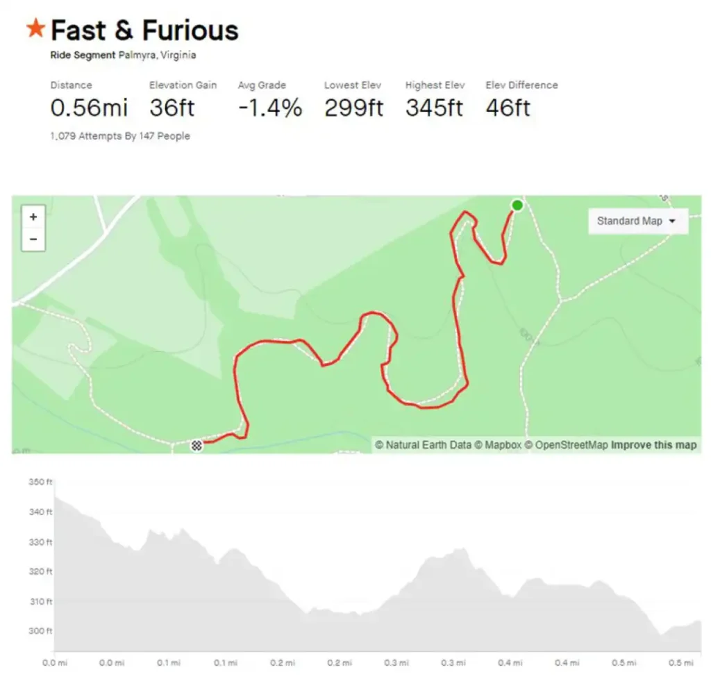
Fast & Furious
Distance:
.56 Miles
Details:
299 – 345 lowest to highest elevation
Notes:
Fast & Furious is a half mile Strava Segment that can be accessed from kiosk #7 near the ball fields. It covers the newest section of Brush Arbor from Beech Grove to the Rock Brook connector.
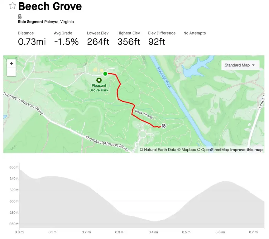
Beech Grove
Distance:
.73 Miles
Details:
264 – 356 lowest to highest elevation
Notes:
Short double track that runs from the kiosk by the baseball fields to the library. Rocky, with 2 small creek crossings ideal for nature hikers and wannabe mountain bikers that need that 30 second rush to feel pro. Finishes with a climb and drops you out at the library where you can continue on Heritage Trail or turn around for a repeat down and up back to where you started. Follow the brown signs.
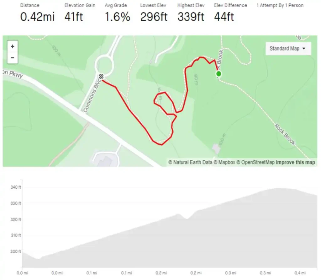
Discovery
Distance:
.42 Miles
Details:
296 – 339 Lowest to highest elevation
Notes:
Trail that comes right off the roundabout from the library. Ideal for the best bird watchin’ in the county. Listen to a red shouldered hawk while watching a warbler chase a mocking bird! Take it out and back for a short hike or continue onto Rock Brook and Horseshoe to drop in on the Heritage. Either way, you’ll catch the best of Fluvanna.
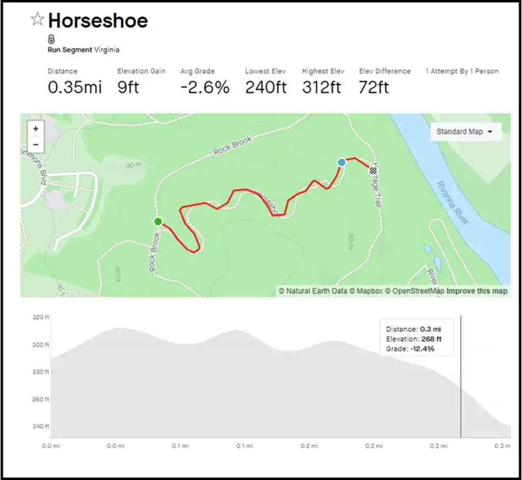
Horseshoe
.35 Miles
Details:
240 – 312 Lowest to highest elevation
Notes:
Short, twisty, turvey single track connector that joins Heritage Trail to Rock Brook. It roller coasters its way through cedars and pine just enough to make you feel lost before dropping you off on one of the major trails. Not too far from the library or the dog park.
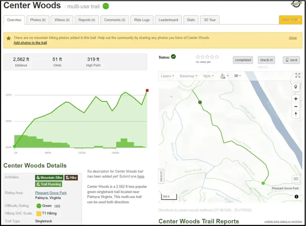
Center Woods
Distance:
.48 Miles
Details:
N/A
Notes:
Connector type trail that links Beech Grove to Boulder Forest. It slices right through the middle of the Boulder Forest Loop with views of cedar, native hard woods, and you guessed it, ferns. Comes to a T at a giant bolder perfect for little climbers. Use it as an out and back or finish the loop on Boulder Forest back to Beech Grove.
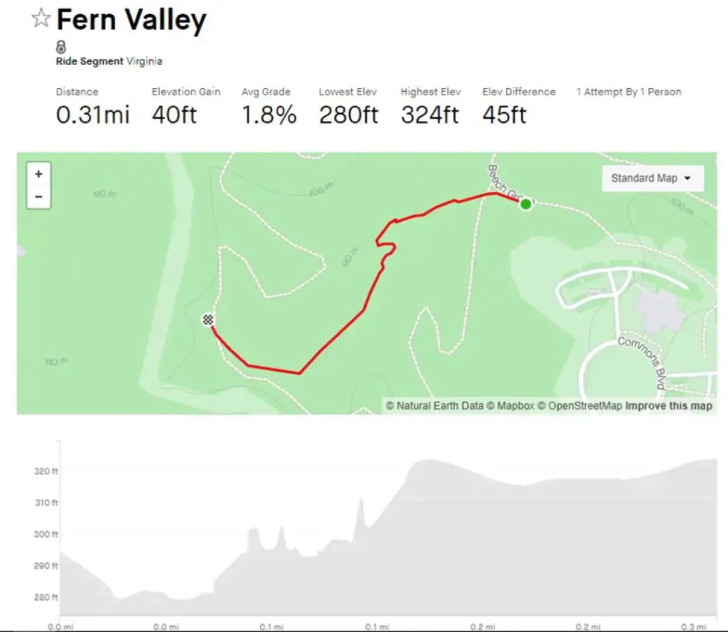
Fern Valley
Distance:
.31 Miles
Details:
280 – 324 lowest to highest elevation
Notes:
Connector type trail that links Beech Grove to Boulder Forest. It slices right through the middle of the Boulder Forest Loop with views of cedar, native hard woods, and you guessed it, ferns. Comes to a T at a giant bolder perfect for little climbers. Use it as an out and back or finish the loop on Boulder Forest back to Beech Grove.
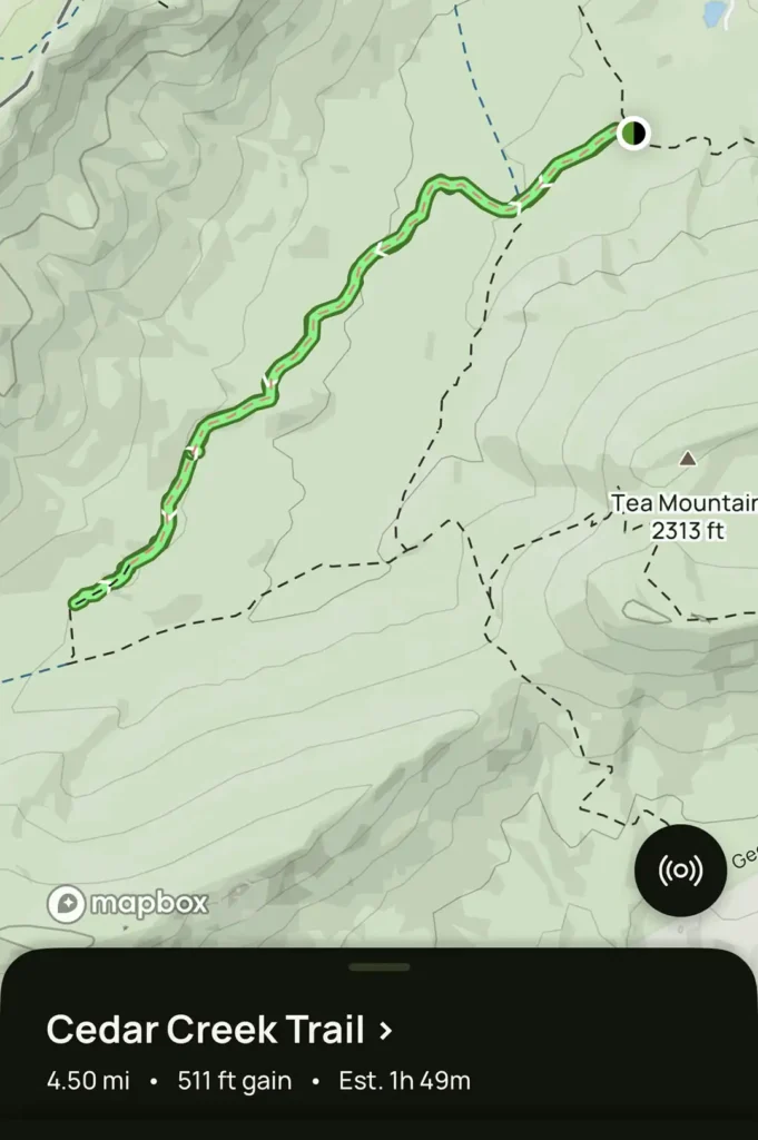
Cedar Creek
Distance:
.32 Miles
Details:
303 – 336 lowest to highest elevation
Notes:
Quarter mile connector that cuts though the disc golf course on Brush Arbor. Shortly after passing the stage near the pole barn, take your first left onto Cedar Creek for a quick technical down-up-down-up with a quick teaser of the disc golf course. It will drop you back on to Brush Arbor between hole 11 and 12.
Need to Know: Riding Pleasant Grove
Main Entrance
Eastern Trailhead
What else to do at Pleasant Grove?
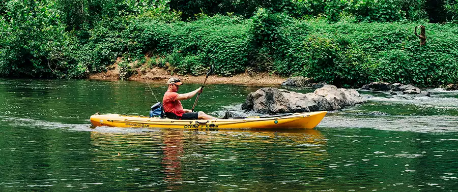
Incredible nature all around!
- Trails also open for hiking and horse back riding
- Park features extensive frontage on the Rivanna River, Virginia’s first designated scenic river.
- Sandy Beach, Kayak/Canoe, fish and more.

